air (or the northeast trades), cumuliform clouds
increase. Here we are considering only Northern
Hemisphere situations; however, a comparable pattern
exists in the Southern Hemisphere.
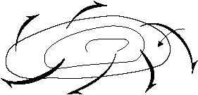
A typical breakdown of the weather conditions you
may encounter in air masses around the subtropical
highs (fig. 6-8) is as follows:
1.
North of a subtropical high. Any mT air that
moves northward becomes cooled over the cool ocean
surface. A stratus overcast may form, and drizzle may
fall. Farther north, low ceilings (usually below 1,000
feet) may reach the surface, producing fog. The mT air
surges farthest north in summer because subtropical
highs are best developed and polar fronts lie farthest
north. This mT air brings most of the summer fogginess
to northern seas and coasts. It brings the greatest
fogginess in the Atlantic where it blows from the warm
Gulf Stream over the cold Labrador Current (near
Newfoundland), and in the Pacific where it blows from
the warm Kuroshio Current over the cold Oyashio
current (near the Kamchatka peninsula).
2.
East of a subtropical high. Along the California
coast, and along the Atlantic coast of North Africa, the
mT air blows from the west and the northwest. This air
tends to remain stable for the following reasons:
a.
It is coming from the northern, cooler
portion of the source region.
b.
Its surface layers remain cool because it
moves over cold ocean currents.
c.
Its upper portions warm adiabatically
because of subsidence.
Throughout the year, airways are smooth. The skies
are clear to partly cloudy. Clouds are generally patches
of stratocumulus, and rain is rare. The chief flight
hazard in this air is coastal fog, which often hides the
California or European coastal land. Stratus and
stratocumulus clouds may cause the sky to be overcast,
develop low ceilings, and produce drizzle that reduces
visibility.
3.
South of a subtropical high. Where the mT air
moves southward or southwestward (as trade winds),
its lower layers are warmed by the tropical ocean
surface. This produces scattered cumulus. Near the
equator, after absorbing much moisture and being
heated, this air may develop cumulonimbus.
4.
West of a subtropical high. This mT air blows
from the east and the southeast. Since it flows over
warm water all of the way, the air neither cools nor
warms. Over the ocean near the Philippines (and near
Florida and the West Indies), this trade wind brings
good flying weather—clear or scattered cumulus
clouds. When it is moving over land, this warm, moist
air becomes unstable and turbulent and is a source of
thunderstorms. When it moves over cold land (for
example, southeastern United States in the winter), it
becomes stable and produces stratus clouds or fog.
Over cold ocean surfaces, such as the Sea of Japan and
the Kamchatka and Labrador currents, it develops the
persistent low stratus and fogs characteristic of these
areas.
ARCTIC AND ANTARCTIC WEATHER
Geographically, the arctic zone is north of the
Arctic Circle (66.5°N) and the Antarctic zone is south
of Antarctic Circle (66.5°S) The Arctic is extremely
important to the military defense of Canada and the
United States and is the subject of ever-increasing
military operations. Therefore, Aerographer’s Mates
must familiarize themselves with the prevailing
weather and peculiarities of these regions.
6-21
SUBTROPICAL
ANTICYCLONE
H
AIR STABLE
TRADES (DRY LITTLE
RAINFALL)
AIR UNSTABLE
(WET)
AIR STABLE (POSSIBLE FOG & STRATUS)
SUBSIDENCE INVERSION
(STRONG) AIR STABLE
(RELATIVELY DRY
CLIMATE)
SUBSIDENCE
WEAK
AIR NEUTRAL
OR
UNSTABLE
(WET)
(PRECIPITATION
ABUNDANT)
AG5f 0608
Figure 6-8.—Weather, winds, and stability conditions around the subtropical high.


