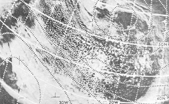
Figure 4-8.-Open cells on satellite Imagery.
When this polar air mass moves out over the water,
the moist layer is shallow and capped by a subsidence
inversion near the coast. Further downstream the
vertical extent of the moist layer and the height of the
clouds increases due to air mass modifications by the
underlying surface. In figure 4-8, the open cells behind
a polar front over the North Atlantic indicate cold air
advection and cyclonic curvature of the low-level wind
flow. Vertical thickness of the cumulus at A is small,
but increases eastward toward B.
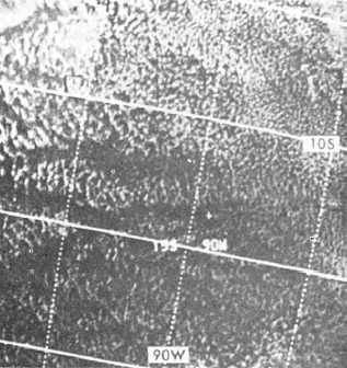
Figure 4-9 shows a large area of the subtropical
high west of Peru covered with open cells. These are
not associated with low-level cyclonic flow or steady
cold air advection.
Closed Cellular Cloud Patterns
Closed cellular cloud patterns are characterized by
approximately polygonal cloud-covered areas bounded
by clear or less cloudy walls. Atmospheric conditions
necessary for the formation of closed cells are weak
convective mixing in the lower levels, with a cap to this
mixing aloft. The convective mixing is the result of
surface heating of the air or radiational cooling of the
cloud tops. This type of convection is not as intense as
that associated with open cells. The cap to the
instability associated with closed cellular cloud
patterns is in the form of a subsidence inversion in
both polar and subtropical situations. Closed cellular
cloud patterns are made up of stratocumulus elements
in both the polar and subtropical air masses. In
addition to the stratocumulus elements, trade-wind
cumulus may also be present with the subtropical
highs. When associated with the subtropical highs,
closed cellular clouds are located in the eastern
sections of the high-pressure area. Closed cells are
associated with limited low-level instability below the
subsidence inversion. Extensive
Figure 4-9.-Open cells in the subtropical high.
4-7


