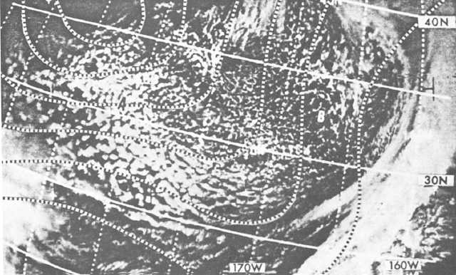
vertical convective activity is not likely. Figure 4-10
shows closed cells in the southeastern portion of a
polar high near A.
Figure 4-11 shows closed cells in the eastern portion
of a subtropical high in the South Pacific. West of A,
the closed cells are composed of stratocumulus with
some clear walls, and east of the walls, the cells are
composed of thinner clouds.
The practical training publications, Satellite
Imagery Interpretation in Synoptic and Mesoscale
Meteorology, NAVEDTRA 40950, and Tropical Clouds
and Cloud Systems Observed in Satellite Imagery,
Volume
1,
NAVEDTRA
40970,
offer
further
information on the subject of satellite interpretation.
VERTICAL MOTION AND
WEATHER
Upward vertical motion (convection) is associated
with increasing cloudiness and precipitation, and
downward vertical motion (subsidence) with improving
weather.
Vertical motion analyses and prognostic charts are
currently transmitted by the NWS and FNMOC. The
values are computed and are on the charts. charts.
Plus values represent upward vertical motion
(convection), and minus values represent downward
vertical motion (subsidence).
VORTICITY AND PRECIPITATION
Vorticity was discussed in chapter 1 of this manual,
as well as the AG2 TRAMAN, volume 1. We have seen
that relative vorticity is due to the effects of both
curvature and shear. Studies have led to the following
rules:
Cloudiness and precipitation should prevail in
regions where the relative vorticity decreases
downstream.
Fair weather should prevail where relative
vorticity increases downstream.
The fact that both shear and curvature must be
considered when relative vorticity changes are
investigated results in a large number of possible
combinations on upper air charts. When both terms are
in agreement, we can confidently predict precipitation
or fair weather. When the two are in conflict, a closer
examination is required.
Figure 4-10.-Closed cells in polar high.
4-8


