reporting surface-pressure rises is the best criterion of
its passage. This should be verified by reference to
plotted raob soundings where available. When a Pacific
cold occlusion moves farther inland, it sometimes
encounters colder air of appreciable depth over the
Plateau or Western Plains areas; in this case, it should
be redesignated as an upper cold front.
Surface Characteristics
The occlusion lies in a low-pressure area; and in the
latter stages, a separate low center may form at the tip of
the occlusion, leaving another low-pressure cell near
the end of the occlusion. The pressure tendency across
the cold occluded front follows closely with those
outlined for cold fronts; that is, they level off, or more
often, rapid rises occur after the passage of the
occluded front.
Weather
In the occlusion’s initial stages of development, the
weather and cloud sequence ahead of the occlusion is
quite similar to that associated with warm fronts;
however, the cloud and weather sequence near the
surface position of the front is similar to that associated
with cold fronts. As the occlusion develops and the
warm air is lifted to higher and higher altitudes, the
warm front and prefrontal cloud systems disappear. The
weather and cloud systems are similar to those of a cold
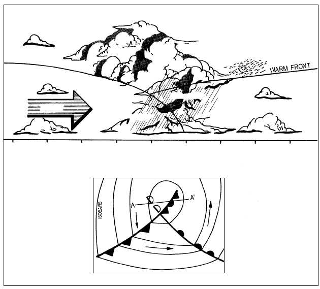
front. View A of figure 4-39 shows the typical cloud
and weather pattern associated with the cold occlusion.
Most of the precipitation occurs just ahead of the
occlusion. Clearing behind the occlusion is usually
rapid, especially if the occlusion is in the advanced
stage. Otherwise, clearing may not occur until after the
passage of the warm front aloft.
4-41
WARM AIR
COLD FRONT
COLD AIR
FLOW
COOL AIR
ALTOSTRATUS
CIRRUS
STRATOCUMULUS
NIMBOSTRATUS
STRATOCUMULUS
RAIN
250
200
150
100
150
0
50
100
150
DISTANCE MILES
COLD AIR
COOL AIR
B
A
WARM AIR
AG5f0439
ALTOCUMULUS
Figure 4-39.—Cold front type of occlusion. (A) Vertical structure through points A and A'; (B) horizontal structure.


