over warm water. Evaporation from the surface of the
warm water easily saturates the cold air, causing fog,
which rises from the surface like smoke. It should be
noted that the actual process of heating cold air over a
warm surface tends to produce instability. The presence
of an inversion above the surface prevents steam fog
from rising very high; it is usually fairly dense and
persistent.
This type of fog forms on clear nights over inland
lakes and rivers in late fall before they freeze. It is
prevalent along the Mississippi River and Ohio River at
that time of year. Arctic sea smoke is the name given to
steam fogs in the arctic region. It forms when cold air
moves over a warmer water surface, which is most
often found in breaks of the surface ice. It may also
occur over the ocean surface following a cold frontal
passage when the water is approximately 40°F warmer
than the air passing over it.
Upslope Fogs.—Upslope
fog
is
caused
by
adiabatic cooling of rising air. It is formed when moist,
warm air is forced up a slope by the wind. The cooling
of the air is almost entirely adiabatic, since there is little
conduction taking place between the air and surface of
the slope. The air must be stable before it starts its
motion so that the lifting does not cause convection, or
vertical currents, which would dissipate the fog.
Some wind speed is needed, of course, to cause the
upslope motion. Upslope fog is usually found where the
air moves up a gradual slope. This type of fog is deep
and requires considerable time to dissipate. The most
common fog of this type is called Cheyenne fog and is
caused by the westward flow of air from the Missouri
Valley, which produces fog on the eastern slope of the
Rockies.
Frontal Fog.—Frontal fog is another hazard,
which must be added to the list of weather problems
associated with fronts. The actual fog is due to the
evaporation of falling rain and occurs under the frontal
surface in the cold air mass. This additional water vapor
gradually saturates the air. Precipitation falls from the
lifted warm air through the cold air. Evaporation from
the rain continues as long as the temperature of the
raindrops is higher than the temperature of the air, even
though the cold air is already saturated. Naturally, the
upper regions become saturated first because the
temperature and dew point are lower at the higher
altitude. As the evaporation from the rain continues, a
layer of clouds begins to build down from the frontal
surface. Eventually, this cloud layer extends to the
ground and becomes fog.
During the day, there may be enough turbulence
caused by solar heating to keep this cloud off the
ground. However, after dark, because of dying
convection currents and the nocturnal cooling of the air,
the ceiling drops suddenly. It is this sudden closing in
after dark that makes frontal fog so dangerous.
Cold fronts usually move so rapidly and have such
narrow bands of precipitation and high wind speeds that
cold-front fog is comparatively rare and short lived.
warm-front fog, on the other hand, is fairly common.
Since warm frontal systems are quite extensive,
warm-front fog may cover a wide area. This type fog is
also deep because it extends from the ground to the
frontal surface. The clouds above the frontal surface
also slow down the dissipating effect of solar heating.
5-9
AG5f0504
WIND
WARM OCEAN
FOG OR LOW
STRATUS
COLD COASTAL WATER
COLD CONTINENT
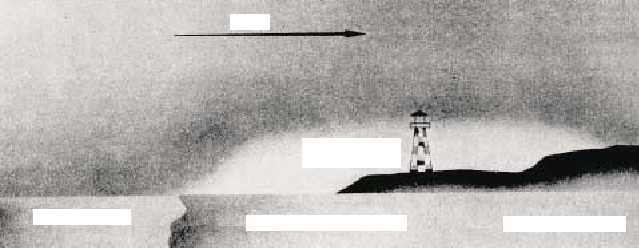
Figure 5-4.—Land advection fog caused by an onshore flow over cold coastal water.


