provides acoustic raytrace diagrams and propagation
loss curves. TOAS computes active and passive USW
range predictions by using operator-input data and a
sensor/platform data base.
Hazard Avoidance-This option contains the
Naval Search and Rescue (NAVSAR) program and the
Tropical Cyclone program. NAVSAR provides
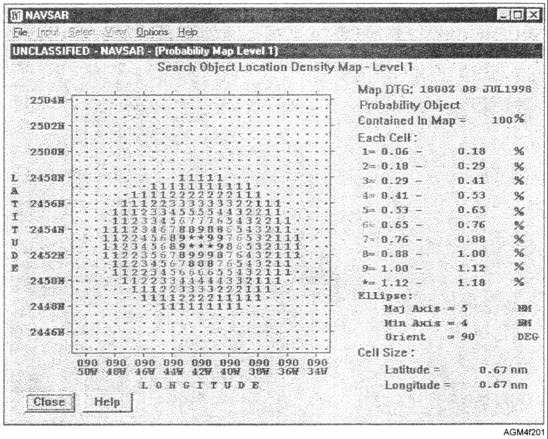
information and planning assistance for search and
rescue incidents at sea, such as search probability maps
(fig. 2-1). The Tropical Cyclone program tracks
tropical cyclone movements and conditions on an
operator-specified map.
Input data is provided by
tropical cyclone messages.
Utilities-The Utility option contains a map
utility function that provides the user with a
geographical map.
These maps are available in
different projections. The utilities option also provides
a briefing support tool (only with GFMPL NT).
REVIEW QUESTIONS
Q3.
What is the purpose of GFMPL?
Q4.
Q5.
Q6.
Q7.
What publication provides a description of the
various GFMPL software versions?
The analyses and predictions of GFMPL are
based upon what inputs?
The electromagnetic programs in GFMPL are
used to provide calculations for what type of
system?
What programs are contained in the Hazard
Avoidance option of GFMPL NT?
TACTICAL ENVIRONMENTAL
SUPPORT SYSTEM (TESS)
SOFTWARE PROGRAMS
LEARNING OBJECTIVE: Identify the various
software programs available in the Tactical
Environmental Support System, Version 3.0
(TESS 3); TESS-Next Century (NC)
Transition; and TESS-Next Century.
Figure 2-1.—Example of a NAVSAR search probability map from GFMPL NT.
2-5

