spissatus) will continue to thicken downward enough to
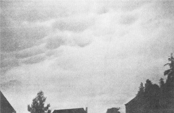
be classified altostratus. Occasionally, rounded bulges
may develop, protruding from the base of the dense
cirrus blow-off. Although found on the dense cirrus or
altostratus blow-off from a cumulonimbus cell, these
rounded bulges are called cumulonimbus mamma, or
simply mamma (fig. 1-14). Mamma is a strong
indicator that conditions are favorable for severe
weather to occur under and near the cumulonimbus
base. Mamma should NOT be interpreted as
developing funnel clouds.
During the dissipation stage, there are more
pronounced downdrafts within the cloud than updrafts.
The remaining updrafts may become more concentrated
and originate from the rear portion of the cloud cell.
Severe weather, such as strong or gusty surface winds,
heavy rain, hail, and tornadoes, usually is confined to
the dissipating stage.
The beginning of the dissipation stage may be
marked by the sudden onset of strong, cold downdrafts,
known as a downrush, exiting the base of the cloud.
These winds are deflected by the ground to create very
gusty, sometimes dangerously strong winds blowing
outward from under the cloud cell. The leading edge
and upward boundary of the bubble of gusty winds form
a distinct boundary known as the gust front or the
outflow boundary. The outflow boundary—a sharply
defined separation between the wind flowing toward
the base of the cloud cell and the strong, cold, outward
flowing wind-typically is associated with low-level
wind shear (LLWS), a dangerous phenomenon that has
caused many fatal aircraft crashes. A particularly
strong, concentrated downrush from the base of the
cloud is known as a microburst. A microburst produces
concentrated, extremely strong straight-line winds
blowing outward from the base of the CB cell.
Typically, these winds produce great damage and are
often initially and incorrectly reported by the public as a
tornado.
A roll cloud (arcus) may form along the leading
edge of the cumulonimbus cloud base during a
downrush. The ragged bottom edge of the roll cloud is
usually much lower than the more uniform base of the
Figure 1-14.—Cumulonimbus mamma on mid-etage altostratus cloud layer.
1-14


