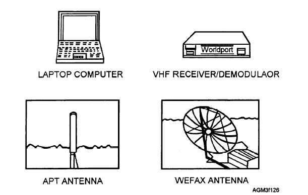
Figure 1-26.—Interim Mobile Oceanography Support System (IMOSS) satellite module.
through processing, gridding, and enhancement
Q41.
Which satellite antenna of the IMOSS satellite
options for various APT direct-readout and WEFAX
module must be manually oriented towards
imagery.
geostationary satellites?
The operator must update satellite ephemeris data
for each polar-orbiting satellite at least once every 2
weeks. Selected prediction information from Part IV
of the TBUS or NASA-2 line bulletins may be
manually entered via the keyboard or copied directly
from a data disk. Orbital-prediction information is
available via message over the Automated Weather
Network (AWN), by standard AUTODIN message, or
by using a computer modem connection to various
sources, such as the Internet.
EPHEMERIS INFORMATION
LEARNING OBJECTIVES: Identify the
various orbital prediction bulletins and explain
how they are obtained. Recognize how data
from satellite orbital prediction bulletins is
used to update user-operated satellite receivers.
Complete information on the operation of the
IMOSS satellite module, including antenna
orientation procedures, updating ephemeris data,
gridding, and display of satellite imagery is contained
in the IMOSS user’s guide. The manual is provided
with each module by the Naval Oceanographic Office.
REVIEW QUESTIONS
Q39. Which types of satellite imagery may be
acquired by using the AN/SMQ-11?
Q40. Which types of satellite imagery may be
acquired by using the IMOSS satellite module?
One of the most critical operations on any of the
direct-readout satellite imagery receiving systems is
the updating of ephemeris data. Ephemeris data is
information that describes the type, orientation, and
shape of a particular satellite’s orbit. Ephemeris data is
critical to satellite tracking as it provides key
information that allows you to determine where a
satellite will be located at any given moment. This
information is also used to allow the receiver system to
predict where polar-orbiting satellites will be at any
moment in relation to the location of the receiver site.
More importantly, ephemeris information enables
your receiver system to earth-locate the image, that is,
to establish what area of the earth is depicted in an
1-30


