infrared image when surface temperatures and cloud
top temperatures are relatively the same.
Water Vapor Imagery
Concentrations of water vapor in the atmosphere
absorb essentially all 6.7 µm radiation coming from
below. Thus, one of the infrared sensors carried
aboard the GOES and the METEOSAT measures
radiation at this wavelength. When the energy
measurements from this type of sensor are composed
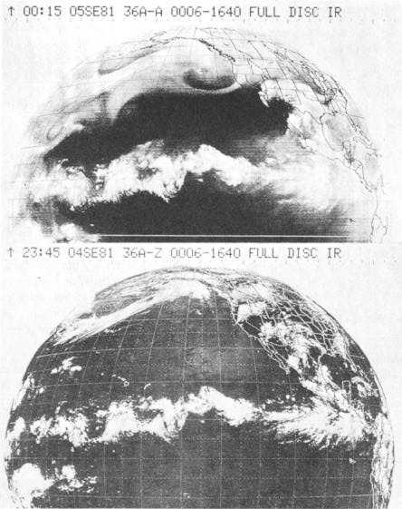
into an image, the result, shown in figure 1-13, is called
a water-vapor channel or WV image. Areas of high
water-vapor content (high humidity) appear in the
lighter gray shades while lower humidity areas appear
darker.
The main advantage of the water vapor channel is
better definition of the moisture distribution in the
upper atmosphere. If moisture is present in the upper
levels, we associate this with upward vertical motion.
Conversely, upper-level dryness is a good indication
Figure 1-13.—GOES full disk (hemisphere) infrared water-vapor (WV) channel image (top) and full disk visual (VIS) image
(bottom) at the same time. The WV image shows a better depiction of the extent of the system than the VIS image.
1-13


