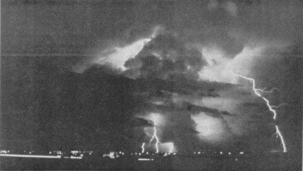
The vast majority of lightning discharges jump
from cloud to cloud, and are abbreviated on
observations as LGTCC. A smaller number of
discharges appear to occur entirely within a single cloud
(LTGIC) or from a cloud to the surrounding clear air
(LTGCA). Only a small percentage of lightning
discharges occur from cloud to ground (LTGCG) (fig.
1-28). Cloud-to-ground lightning may strike up to 12
miles from the rainfall area in a thunderstorm (fig.
1-29).
Other rarer forms of lightning are ball lightning or
St. Elmo's Fire, and lace lightning. Ball lightning
appears as ball-shaped parcels of brightly glowing
electricity; it may be stationary on a sharp object such as
an antenna, mast, or the ridge of a roof; or it may be
falling, rolling across a surface, or even bouncing over
the ground. Different reports state ball lightning may
penetrate windows or wooden walls with little or no
trace of passage, while others attribute great damage to
ball lightning contact. Ball lightning has been reported
to explode in a shower of sparks upon contact with
stationary objects.
Lace lightning is occasionally seen moving across
the sky through a heavy cirrus spissatus cloud layer well
downstream of larger thunderstorms. It appears to
move across the sky in pulses forming a fine weblike or
lacelike network through the cirrus cloud.
In surface aviation weather observations,
thunderstorms are considered to have begun when the
first thunder is heard or when overhead lightning is
observed, and the local noise level is high enough as
might prevent the observer from hearing thunder.
Direction, estimated distance to the leading edge of the
storm, and direction of movement should be noted if
possible. As the storm gets closer, the types of the
lightning discharges should be noted, along with the
frequency of the lightning discharges, such as
occasional lightning or frequent lightning. The
Lightning Detection and Tracking System (LDATS)
equipment in use at several Navy and Marine Corps
weather offices will assist the observer in determining
distance, direction, and speed of movement of
thunderstorms. Many stations have requirements to set
thunderstorm conditions to warn base personnel of
anticipated or impending thunderstorm activity. The
observer’s input as to the existence of thunderstorms,
their location, and movement is critical to the
thunderstorm warning system.
Figure 1-28.—Cloud-to-ground lightning under a cumulonimbus cloud base.
1-36


