25NP0041
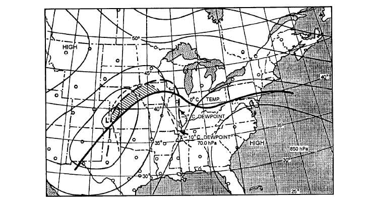
Figure 4-25.-Illustration of the location of the maximum snow area. The low center moved to Iowa in 24 hours, and the maximum
snow area spread northeast along the area 50 to 75 miles either side of a line through Minneapolis to Houghton, Michigan.
causing daytime temperature readings to be
relatively lower than normally expected, and
nighttime temperatures to be relatively higher. The
stability of the lapse rate has a marked effect on
insolation and terrestrial radiation. With a stable
lapse rate, there is less vertical extent to heat;
therefore, surface heating takes place more rapidly.
With an unstable lapse rate, the opposite is true. If
there is an inversion, there is less cooling, since the
surface temperature is lower than that of the inversion
layer; that is, at some point the energy radiated by the
surface is balanced by that radiated by the inversion
layer.
Advection
One of the biggest factors affecting temperature is
the advection of air. Advection is particularly marked
in its effect on temperature with frontal passage. If a
frontal passage is expected during the forecast period,
the temperature must be considered. Advection within
an air mass may also be important. This is particularly
true of sea and land breezes and mountain breezes. They
affect the maximum and minimum temperatures and
their time of occurrence.
Vertical Heat Transport
Vertical heat transport is a temperature factor. It is
considerably affected by the windspeed. With strong
wind there is less heating and cooling than with light
wind or a calm because the heat energy gained or lost is
distributed through a deeper layer when the turbulence
is greater.
Evaporation and Condensation
Evaporation and condensation affect the
temperature of an air mass. When cool rainfalls through
a warmer air mass, evaporation takes place, taking heat
from the air. This often affects the maximum
temperature on a summer day on which afternoon
thundershowers occur. The temperature may be
affected at the surface by condensation to a small extent
during fog formation, raising the temperature a degree
or so because of the latent heat of condensation.
FORECASTING SPECIAL SITUATIONS
The surface and aloft situations that are indicative
of the onset of cold waves and heat waves are discussed
in the following text.
4-31


