• Home
  • Download PDF
  • Order CD-ROM
  • Order in Print
Military Grid Reference System
Figure 4-3.Relationship between grid zone and 100,000-meter squares

Aerographers Mate, Module 01-Surface Weather Observations
Page Navigation
  131    132    133    134    135  136  137    138    139    140    141  
Page 4-3 
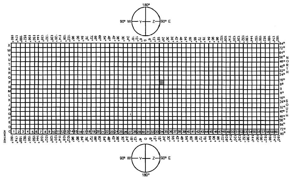
Figure 4-2.—Military Grid Reference System using Universal Transverse Mercator (UTM) grid between 84°N and 80°S latitudes and Universal Polar Stereographic (UPS) grids in the polar regions. Grid squares are identified with the column number first, and then the row letter.


Western Governors University

Privacy Statement
Press Release
Contact

© Copyright Integrated Publishing, Inc.. All Rights Reserved. Design by Strategico.