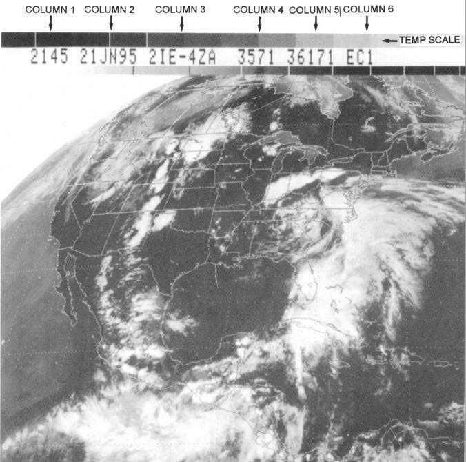
top of figure 1-20. Column 1 is the Universal
Coordinated Time (UTC) and column 2 is the date of the
image. The first number in column 3 indicates line
stretcher/data buffer identification data and the first
letter is the satellite identification indicator (I=GOES 8,
J=GOES 9). The second letter in column 3 is the image
type, which will be either "F" for full disk IR, "E" for the
equivalent IR sector, or "A", "B", "C", "D" for the
visible sectors. The next number in column 3 is the
resolution in kilometers, and the last two letters in
column 3 indicate the type of enhancement curve (IR
imagery only). Columns 4 and 5 are for use by satellite
specialists.
Column 6 of the GOES legend indicates the sector
identification of the image. The term sector refers to
the segments of a GOES image that are expanded or
contracted to the desired geographic region of a
particular GOES-TAP distribution site. The first letter
indicates the satellite field distribution site for which
Figure 1-20.—A GOES 8 EC1 infrared sector taken at 2145 UTC, June 21,1995. The GOES legend is at the top of the image.
1-20


