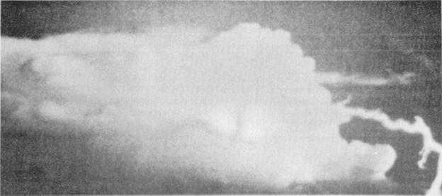
Figure 1-29.—Cloud-to-ground lightning from the side of cumulonimbus calvus cloud to ground several miles from the cloud base.
Auroras
Auroras are luminous phenomena that appear in the
high atmosphere in the form of arcs, bands, draperies, or
curtains. These phenomena are usually white but may
have other colors. The lower edges of the arcs or
curtains are usually well defined; the upper edges are
diffuse. Polar auroras are caused by electrically
charged particles ejected from the sun that act on the
rarified (select) gases of the upper atmosphere. The
particles are channeled by earth’s magnetic field, so
auroras are concentratednear the magnetic poles. In the
Northern Hemisphere, they are known as the Aurora
Borealis, while in the Southern Hemisphere they are
known as the Aurora Australis. Another form of the
aurora is airglow. Airglow is fainter and lacks
definition, but may be seen in the low and middle
latitudes as a faint glow in the sky. Unless remarkably
intense or vivid, auroras are not reported in surface
aviation observations. Shipboard observers will only
report auroras when located north of 45" north latitude
or south of 45" south latitude.
PHOTOMETEORS
Photometeors consist of a number of atmospheric
phenomena attributed to the reflection or refraction of
visible light in the sky by liquid water droplets, ice
crystals, by the air itself, or by solid particles in the air,
such as volcanic ash or dust. Several types of
photometeor phenomena may be used to assist in the
identification of cloud type, such as the halo, corona,
irisation, and rainbows. Fogbows are classified as
photometeors, as are superior mirages (objects such as
buildings, trees, or mountains seen inverted in the sky)
and inferior mirages (shimmering wet appearance of
hot surfaces such as roads or sand). Other than aiding in
the identification of other phenomena, these
phenomena are not significant in surface aviation
weather observations; therefore, they are not reported.
Of the weather elements we have discussed to this
point, most of the identification of the phenomena is
based on the observer’s knowledge and on what the
observer sees directly. Sure, instruments are in use to
help the observer determine visual range and cloud
height, but the only method to determine cloud type and
what type of weather is occurring is by the observer’s
classification. Many of the remainder of the observable
elements for a surface aviation weather observation are
directly obtainable from instruments, so our
explanation should be somewhat easier for the
remainder of the chapter. Let’s continue with the next
section on observing the pressure.
1-37


